The Dawei Road Link, a planned 138-kilometer highway linking Bangkok to a 260-square-kilometer SEZ in Myanmar, bisects regional ecological corridors. This map shows the design team’s intervention sites used to convey landscape impacts, predict wildlife crossings, and test design strategies, 2016.
Bio-engineering technologies, principally for erosion control of tropical mountainous roads, are scoped for their additional potential to create micro-habitat, minimize degraded forest edges, and involve local communities in landscape maintenance, 2016.
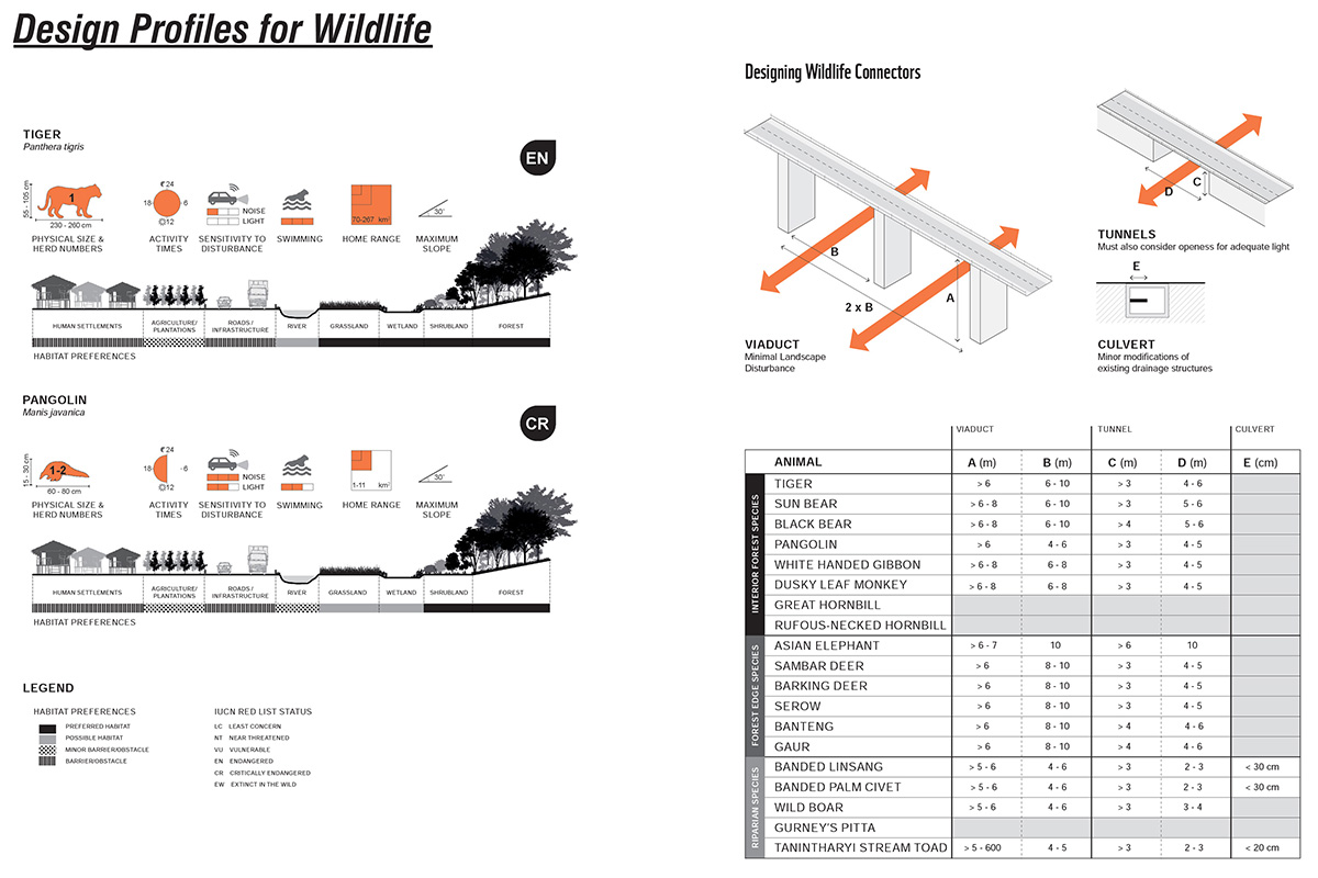
The Design Manual compiles detailed profiles of 20 threatened or endemic species typical of the project area, including critical behavioral aspects and dimensions necessary for infrastructure and mitigation design along the length of the Dawei Road Link, 2016.
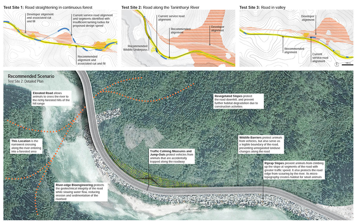
Three prototypical sites are designed, with three scenarios each, to contrast the cost-centric engineering choices with low-impact landscape strategies. The recommended scenario shows the importance of design upstream in the planning process to minimize expensive late-stage mitigation, maintenance and monitoring, 2016.
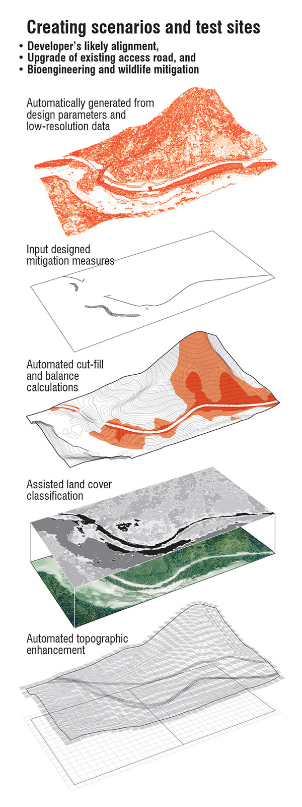
Test sites for design experimentation combined low-resolution global data with additional inputs including designed wildlife mitigation features, automated engineering cut and fill calculations, and land cover enhancement, 2016.
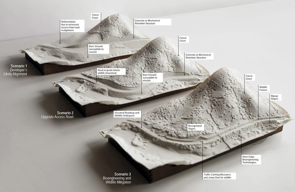
3D-printed design scenario models, 2016.
3D-printed landscape models, used in developer and government stakeholder meetings, contrast three design scenarios for a single site, including: 1) Developer’s likely alignment and construction; 2) Upgrade of access road; and 3) Bioengineering and wildlife mitigation. Printed with plant-derived plastics, 2016.
3D-printed design scenario models, 2016.
Advocating design as integral to upstream planning, especially without public EIAs and scarce environmental data, we developed tools, including semi-automated design scenarios and optimization algorithms for wildlife prediction, to fill in planning knowledge and data gaps, 2016.
Multi-species corridor models, a current challenge in landscape ecology, were optimized by the design team based on eight principles, including: maximizing species movement rates, minimum number of crossing per species, distance between crossings, cold spot reduction, and corridor continuity, 2016.
Twelve wildlife crossing segments (not points), flexible enough to take into account local cost engineering and mitigation measures outlined in the accompanying Design Manual, were identified by the design team, 2016.