Teaching

Studio Nepal

Instructor: Ashley Scott Kelly

At The University of Hong Kong

Course abstract:

Regional corridors tied to China's 2013 One Belt One Road strategy are set to connect Eurasian economic centers through some of the last frontiers of Central and South Asia. In efforts to expand China's overproduction into India's markets, land routes such as the Bangladesh-China-India-Myanmar (BCIM) economic corridor and rail via Tibet and Nepal are in various stages of planning and construction. At their seam along the foothills of the Himalayas are critical landscapes long conserved by their relative isolation and distance from the state. However, increased investments in road, rail, and hydropower infrastructure, as well as a profusion of planned Special Economic Zones, are stressing long-held center-periphery binaries between Kathmandu and the far eastern, western and Terai regions of the country. China is now Nepal's leading source of foreign direct investment, bilateral trade, and, as of the devastating earthquakes of April and May 2015, its greatest single source of humanitarian aid. Given the proliferation of new projects and agendas, this landscape planning studio sought alternative models of infrastructural and environmental management, engineering, and economic and social integration in Nepal's frontier regions.

    For the first half of the course, students researched Nepal's "failed" development and common misconceptions in development approaches, focusing on trends in investment, geophysical processes, and agricultural and forestry land management issues. Students then traveled Nepal's central north-south corridor from Kathmandu to Chitwan National Park to meet with major international NGOs, including the World Wildlife Fund's linear infrastructure team and the International Centre for Integrated Mountain Development, local landscape academics and design offices, and community forest user groups. Upon their return, students developed design strategies that included alternative Environmental Impact Assessment scopes, scenario-based approaches to linear infrastructure and wildlife connectivity, and parameterizing landscape technologies in response to geophysical hazards and complex land rights.

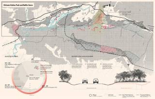
    Fabricating Site. By ZHUANG Zikai, 2016.
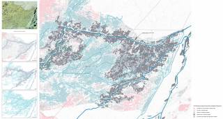
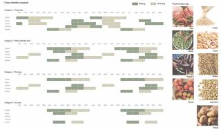
    Fabricating Site. By ZHUANG Zikai, 2016.
    Student research and field photos exhibited at studio final review, 2016.
    Student research and field photos exhibited at studio final review, 2016.
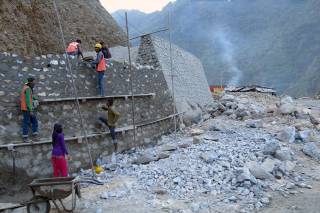
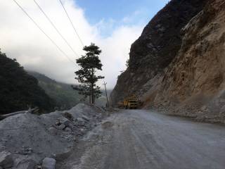
    Narayanghat-Mugling Highway. By Ashley Scott Kelly, 2016.
    Narayanghat-Mugling Highway. By Ashley Scott Kelly, 2016.
    Chitwan National Park. By LAU Kin Yip Ken, 2016.
    Chitwan National Park. By LAU Kin Yip Ken, 2016.
    Narayanghat-Mugling Highway. By Ashley Scott Kelly, 2016.
    Narayanghat-Mugling Highway. By Ashley Scott Kelly, 2016.
    International Centre for Integrated Mountain Development, Godavari Knowledge Park. By Ashley Scott Kelly, 2016.
    International Centre for Integrated Mountain Development, Godavari Knowledge Park. By Ashley Scott Kelly, 2016.
    Rerouting Conservation: Strategic landscape planning for mitigating human-wildlife conflicts and reconnecting wildlife habitats. By LI Man Hei Bernice, 2016.
    Rerouting Conservation: Strategic landscape planning for mitigating human-wildlife conflicts and reconnecting wildlife habitats. By LI Man Hei Bernice, 2016.
    Rerouting Conservation: Strategic landscape planning for mitigating human-wildlife conflicts and reconnecting wildlife habitats. By LI Man Hei Bernice, 2016.
    Rerouting Conservation: Strategic landscape planning for mitigating human-wildlife conflicts and reconnecting wildlife habitats. By LI Man Hei Bernice, 2016.
    Rerouting Conservation: Strategic landscape planning for mitigating human-wildlife conflicts and reconnecting wildlife habitats. By LI Man Hei Bernice, 2016.
    Rerouting Conservation: Strategic landscape planning for mitigating human-wildlife conflicts and reconnecting wildlife habitats. By LI Man Hei Bernice, 2016.
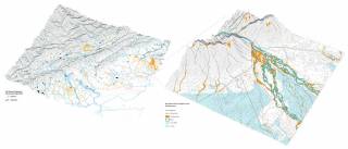
    Soil Metrics: Systematizing scopes of infrastructural design and landscape management for Nepal's Mid-Hills. By GAN Zixuan Alvin, 2016.
    Soil Metrics: Systematizing scopes of infrastructural design and landscape management for Nepal's Mid-Hills. By GAN Zixuan Alvin, 2016.
    Soil Metrics: Systematizing scopes of infrastructural design and landscape management for Nepal's Mid-Hills. By GAN Zixuan Alvin, 2016.
    Soil Metrics: Systematizing scopes of infrastructural design and landscape management for Nepal's Mid-Hills. By GAN Zixuan Alvin, 2016.
    Himalayan Droughtscapes: Water resource equity strategies for drying springs along Nepal's Mid-Hills Highway. By LAU Kin Yip Ken, 2016.
    Himalayan Droughtscapes: Water resource equity strategies for drying springs along Nepal's Mid-Hills Highway. By LAU Kin Yip Ken, 2016.
    Designing infrastructural scope: Iterative landscape planning and scope-setting for Nepal's Trishuli Hydropower projects. By LI Zenming Patton, 2016.
    Designing infrastructural scope: Iterative landscape planning and scope-setting for Nepal's Trishuli Hydropower projects. By LI Zenming Patton, 2016.
    The GLOF Gabion vs. Climate Change: Strategies for road building and ecological connectivity in the Annapurna Conservation Area. By OU Kaiyun Ivanka, 2016.
    The GLOF Gabion vs. Climate Change: Strategies for road building and ecological connectivity in the Annapurna Conservation Area. By OU Kaiyun Ivanka, 2016.
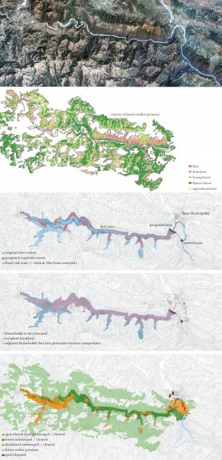
    Tanahu Hydropower Project Retrofit: Forestry and aquaculture through EIA critique. By WONG Yee Fung Yves, 2016.
    Tanahu Hydropower Project Retrofit: Forestry and aquaculture through EIA critique. By WONG Yee Fung Yves, 2016.
    Tanahu Hydropower Project Retrofit: Forestry and aquaculture through EIA critique. By WONG Yee Fung Yves, 2016.
    Tanahu Hydropower Project Retrofit: Forestry and aquaculture through EIA critique. By WONG Yee Fung Yves, 2016.
    Tanahu Hydropower Project Retrofit: Forestry and aquaculture through EIA critique. By WONG Yee Fung Yves, 2016.
    Tanahu Hydropower Project Retrofit: Forestry and aquaculture through EIA critique. By WONG Yee Fung Yves, 2016.
    Redefining "low-impact": Edge effects, fragmentation, and land change along transmission corridors in the Annapurna Conservation Area. By ZHENG Zhicheng Edward, 2016.
    Redefining "low-impact": Edge effects, fragmentation, and land change along transmission corridors in the Annapurna Conservation Area. By ZHENG Zhicheng Edward, 2016.
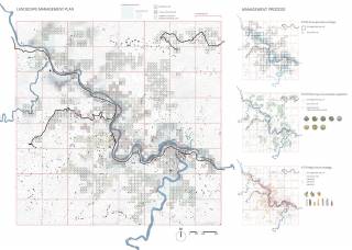
    Fabricating site: Nuanced scenario modelling and infrastructural strategies for Karnali River floodplain and wildlife corridor. By ZHUANG Zikai, 2016.
    Fabricating site: Nuanced scenario modelling and infrastructural strategies for Karnali River floodplain and wildlife corridor. By ZHUANG Zikai, 2016.
    Fabricating site: Nuanced scenario modelling and infrastructural strategies for Karnali River floodplain and wildlife corridor. By ZHUANG Zikai, 2016.
    Fabricating site: Nuanced scenario modelling and infrastructural strategies for Karnali River floodplain and wildlife corridor. By ZHUANG Zikai, 2016.
    Fabricating site: Nuanced scenario modelling and infrastructural strategies for Karnali River floodplain and wildlife corridor. By ZHUANG Zikai, 2016.
    Fabricating site: Nuanced scenario modelling and infrastructural strategies for Karnali River floodplain and wildlife corridor. By ZHUANG Zikai, 2016.
    Fabricating site: Nuanced scenario modelling and infrastructural strategies for Karnali River floodplain and wildlife corridor. By ZHUANG Zikai, 2016.
    Fabricating site: Nuanced scenario modelling and infrastructural strategies for Karnali River floodplain and wildlife corridor. By ZHUANG Zikai, 2016.
    Fabricating site: Nuanced scenario modelling and infrastructural strategies for Karnali River floodplain and wildlife corridor. By ZHUANG Zikai, 2016.
    Fabricating site: Nuanced scenario modelling and infrastructural strategies for Karnali River floodplain and wildlife corridor. By ZHUANG Zikai, 2016.