Teaching

Landscape Media

Instructor: Ashley Scott Kelly

At The University of Hong Kong

Course abstract:

Visual communications for landscape architects, as it's taught and practiced, is often appropriated and derivative from technologies and pedagogies of architecture and planning. However, landscape confronts forms, material conditions, and ecological processes more complex than the other design disciplines. Landscape Media is a shift in approach to medium and digital environments. Quickly moving beyond the acquisition of data and the digital automation of repetitive tasks, this course offers a landscape-centric approach to digital media that focuses on the manipulation and creation of data, i.e., the "fabrication" of missing information and spatial description across many scales. This requires critical and ethical reflection on data organization, spatially explicit methodologies, and the exhibition or reproduction of information in derivative forms. Lectures address the evolution of terrain- and surface-based representation and technologies from the origins of Geographic Information Systems (GIS) in the 1960s, 1990s digital revolution in architecture, datascapes, and advancements in point-cloud data in the 2000s.

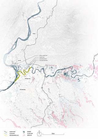
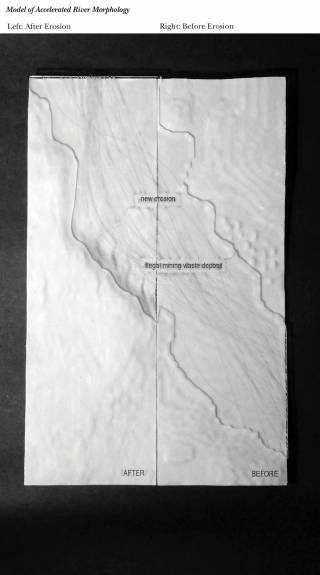
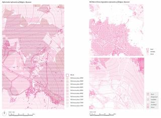
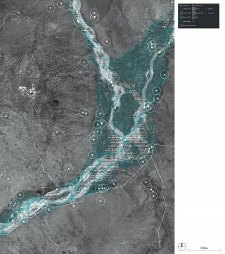
    For their term projects, students have explored conflicts between development, environmental degradation, and engineered-environmental systems at sites across South and Southeast Asia. This past year, students flexed their new digital design theory and skills in digital technology to reflect on a set of Hong Kong-sited landscape ecology literature. These included topics on: historical data integration for long-term modelling of forest succession; high-resolution modelling of urban habitat ecological connectivity; broad-species habitat modelling for tourism planning; cumulative environmental impact assessment; and geotechnical slope stability risk assessment.

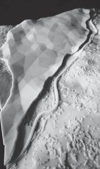
    3D-printed study model of landscape patterns at sample site Muara Labuh, Sumatra. By TSANG Yik Ming Yammi, 2018.
    3D-printed study model of landscape patterns at sample site Muara Labuh, Sumatra. By TSANG Yik Ming Yammi, 2018.
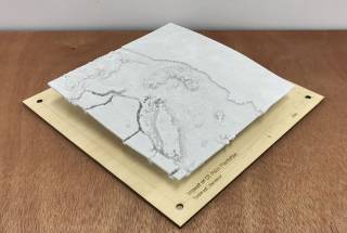
    3D-printed study model of oil palm development and habitat degradation in central Sumatra. By FAN Junyi Roy, 2018.
    3D-printed study model of oil palm development and habitat degradation in central Sumatra. By FAN Junyi Roy, 2018.
    Exploration of forest succession, dispersal, and composition at multiple sites over 70 years on Tai Mo Shan. By TAN Zhiyu, YAU Hoi Ying Ariel, and ZHOU Hongqiao, 2020.
    Exploration of forest succession, dispersal, and composition at multiple sites over 70 years on Tai Mo Shan. By TAN Zhiyu, YAU Hoi Ying Ariel, and ZHOU Hongqiao, 2020.
    Exploration of forest succession, dispersal, and composition at multiple sites over 70 years on Tai Mo Shan. By TAN Zhiyu, YAU Hoi Ying Ariel, and ZHOU Hongqiao, 2020.
    Exploration of forest succession, dispersal, and composition at multiple sites over 70 years on Tai Mo Shan. By TAN Zhiyu, YAU Hoi Ying Ariel, and ZHOU Hongqiao, 2020.
    Least cost path (LCP) explorations of habitat connectivity across ecological scales in Kowloon. By LAW Pak Lun, LAW Tsz Ho Ivan, and YEUNG Hei, 2020.
    Least cost path (LCP) explorations of habitat connectivity across ecological scales in Kowloon. By LAW Pak Lun, LAW Tsz Ho Ivan, and YEUNG Hei, 2020.
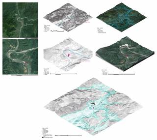
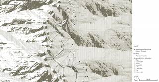
    Landscape impacts around Karinci Seblat National Park, Sumatra. By TSANG Yik Ming Yammi, 2018.
    Landscape impacts around Karinci Seblat National Park, Sumatra. By TSANG Yik Ming Yammi, 2018.
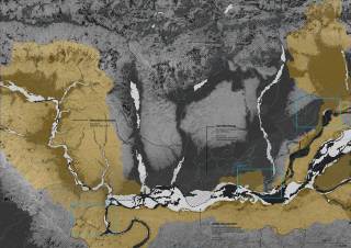
    Study of oil palm development and habitat degradation in central Sumatra. By FAN Junyi Roy, 2018.
    Study of oil palm development and habitat degradation in central Sumatra. By FAN Junyi Roy, 2018.
    Fragmentation and shrinkage of tiger habitat in Kerinci Seblat National Park, Sumatra. By ZHOU Yifan Mia, 2018.
    Fragmentation and shrinkage of tiger habitat in Kerinci Seblat National Park, Sumatra. By ZHOU Yifan Mia, 2018.
    By TAN Rose, 2015.
    By TAN Rose, 2015.
    By SUN Yan Mavis, 2015.
    By SUN Yan Mavis, 2015.
    By SUN Yan Mavis, 2015.
    By SUN Yan Mavis, 2015.
    By JIN Jiayi Jason, 2015.
    By JIN Jiayi Jason, 2015.
    By CHAN Howe Halley, 2016.
    By CHAN Howe Halley, 2016.
    By CHAN Howe Halley, 2016.
    By CHAN Howe Halley, 2016.
    By CHOW Sushakri Patrick, 2016.
    By CHOW Sushakri Patrick, 2016.
    By HU Yiqian Ivy, 2016.
    By HU Yiqian Ivy, 2016.
    By NG Chi Wai Wiley, 2016.
    By NG Chi Wai Wiley, 2016.
    By NG Chi Wai Wiley, 2016.
    By NG Chi Wai Wiley, 2016.
    By WONG Hiu Yan Monique, 2016.
    By WONG Hiu Yan Monique, 2016.
    By WONG Hiu Yan Monique, 2016.
    By WONG Hiu Yan Monique, 2016.
    By WONG Hoo Ming Jeffrey, 2016.
    By WONG Hoo Ming Jeffrey, 2016.
    By WONG Hoo Ming Jeffrey, 2016.
    By WONG Hoo Ming Jeffrey, 2016.
    By ZHANG Shaoyin Shawn, 2016.
    By ZHANG Shaoyin Shawn, 2016.
    By ZHANG Wenli Wendy, 2016.
    By ZHANG Wenli Wendy, 2016.
    By CHEN Xubin Aristo, 2016.
    By CHEN Xubin Aristo, 2016.
    By LI Man Hei Bernice, 2016.
    By LI Man Hei Bernice, 2016.
    By LI Man Hei Bernice, 2016.
    By LI Man Hei Bernice, 2016.
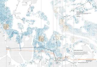
    Three scenarios of road upgrading and potential tiger habitat impact in central Sumatra. By CHIU Ho Wan Isaac, 2020.
    Three scenarios of road upgrading and potential tiger habitat impact in central Sumatra. By CHIU Ho Wan Isaac, 2020.
    Least cost path (LCP) explorations. By LIU Ruixiang Ray, 2020.
    Least cost path (LCP) explorations. By LIU Ruixiang Ray, 2020.
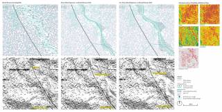
    Ecological heterogeneity across three acacia plantations in central Sumatra. By ZHU Zijing, 2020.
    Ecological heterogeneity across three acacia plantations in central Sumatra. By ZHU Zijing, 2020.
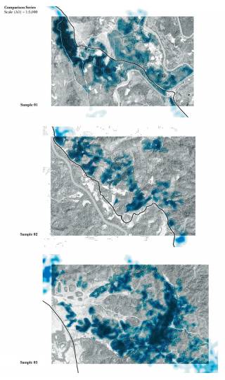
    Least cost path (LCP) comparisons of habitat connectivity under different vegetation classification methods in Kowloon. By Lun Zhentong, Lin Yunpei, and Liu Yiding, 2021.
    Least cost path (LCP) comparisons of habitat connectivity under different vegetation classification methods in Kowloon. By Lun Zhentong, Lin Yunpei, and Liu Yiding, 2021.
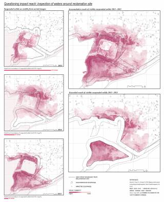
    Problematising expert opinion on cumulative development impacts through mapping turbidity along Lantau Island. By Chung How Yu Jonathan; Man Ting Yan Natalie; Tsim Yuenting Jessica, 2021.
    Problematising expert opinion on cumulative development impacts through mapping turbidity along Lantau Island. By Chung How Yu Jonathan; Man Ting Yan Natalie; Tsim Yuenting Jessica, 2021.
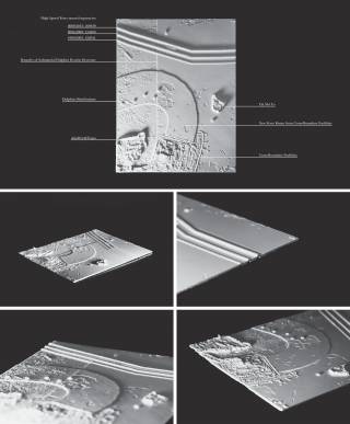
    Problematising expert opinion on cumulative development impacts through mapping turbidity along Lantau Island. By 3D-printed model mapping cumulative development impacts on dolphin populations north of Lantau Island, 2021.
    Problematising expert opinion on cumulative development impacts through mapping turbidity along Lantau Island. By 3D-printed model mapping cumulative development impacts on dolphin populations north of Lantau Island, 2021.